Neighborhood Resilience Planning
Greater Inwood
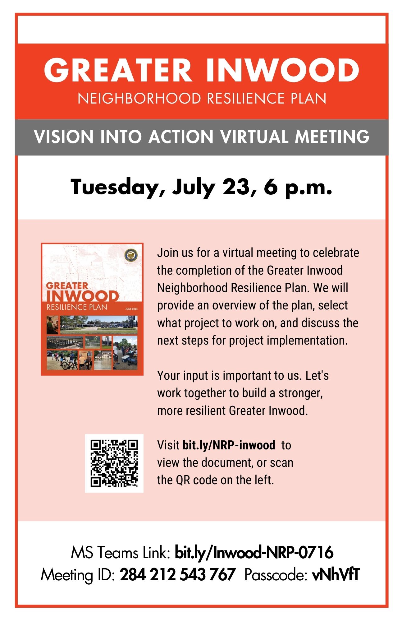
We are delighted to announce that the Greater Inwood Neighborhood Resilience Plan is now complete and available to you. This plan is the result of thorough research, extensive community input, and careful
consideration of both our present and future needs. The plan lays out strategies and actions designed to increase the resilience
of Greater Inwood in the face of flooding, extreme weather, health, environmental or other emergencies. The plan also identifies
opportunities for risk mitigation, economic growth, infrastructure upgrades, and local community empowerment. You can view and
download the plan directly from our website. We strongly encourage all residents to familiarize themselves with the document,
as it plays a vital role in our collective preparedness and resilience. To participate in plan implementation or for more
information, please contact Tonya Sawyer by phone (832) 393-6576 or by email at Email
tonya.sawyer@houstontx.gov.
Over the course of 10 months, the Planning Department was actively engaged with the Greater Inwood community to formulate
the Greater Inwood Neighborhood Resilience Plan. The team took direction from the community via public meetings, surveys,
conversations with community leaders, working sessions with the Neighborhood Support Team (NST), and proactive residents.
The meetings provided the basis for the plan’s development and recommendations.
The Greater Inwood Resilience Plan can be accessed via the link below.
Greater Inwood Neighborhood Resilience Plan
Meeting Info