Historic Districts
Click on a Historic District to see detailed information, including boundaries; history and culture; architectural styles; defining features and setting.
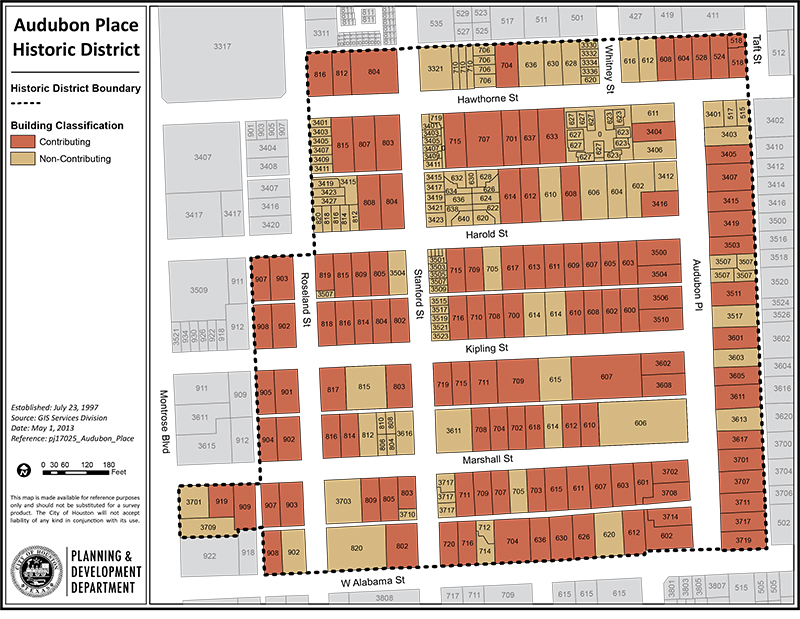
Audubon Place
The Audubon Place Historic District is part of the original Montrose Addition developed in the...
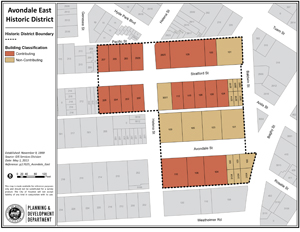
Avondale East and Avondale West
Avondale is a subdivision in the Montrose area of Houston, just a few miles west of downtown. It was designed...
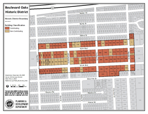
Boulevard Oaks
The Boulevard Oaks Historic District is one of the finest residential neighborhoods constructed during Houston’s building...
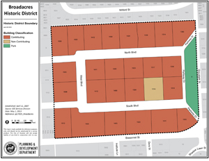
Broadacres
The Broadacres subdivision was developed in the 1920s in Houston’s exclusive...
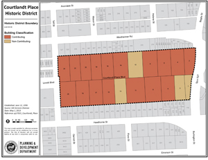
Courtlandt Place
Courtlandt Place was established in 1906 as an exclusive and elegant...
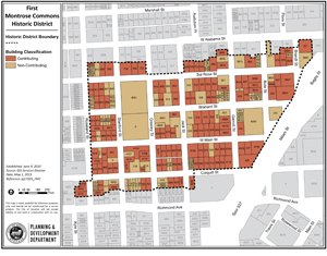
First Montrose Commons
First Montrose Commons was one of several upscale neighborhoods developed in Houston between 1900 and 1925. The historic district consists of two...
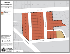
Freeland
First Montrose Commons was one of several upscale neighborhoods developed in Houston between 1900 and 1925. The historic district consists of two...
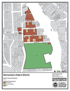
Germantown
The Germantown Historic District is a small wedge of land located east of Woodland Heights and bounded by Houston Avenue to the west, I-45 to the north and east...
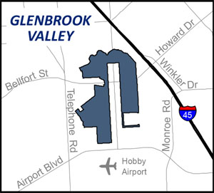
Glenbrook Valley
Glenbrook Valley is a planned community of 1,254 homes in Southeast Houston. It was built in 13 sections...
High First Ward
The High First Ward Historic District is located in Houston’s historic First Ward. Today, the term “First Ward”...
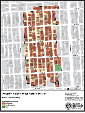
Houston Heights East, South and West
Houston Heights was founded in 1891. It was Texas’ earliest planned community. Houston Heights...
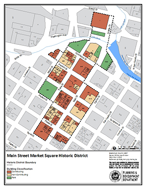
Main Street Market Square
Main Street Market Square is the only commercial historic district in Houston. It is located between...
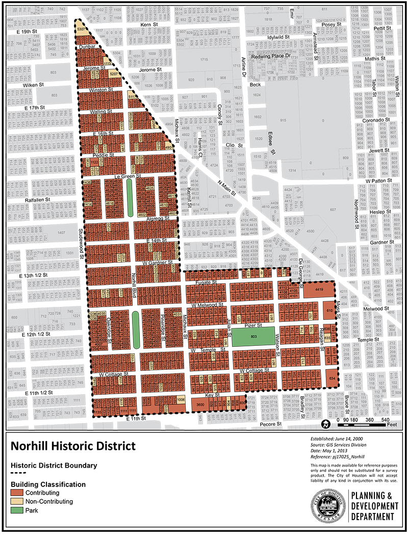
Norhill
The Norhill subdivision north of downtown was a planned community for working-class families. Houston businessman Will Hogg developed...
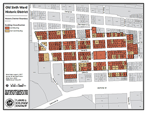
Old Sixth Ward
The Old Sixth Ward, located just west of downtown Houston, maintains the feeling of a modest, self-contained 19th and early...
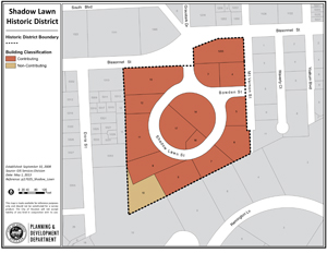
Shadow Lawn
Shadow Lawn was one of the “private enclave” neighborhoods developed in the 1920s. It is near similar South...
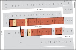
Starkweather
The Starkweather Historic District is within the Independence Heights community, just north of the North Loop segment of Interstate 610. The district is located on East 31½ Street...
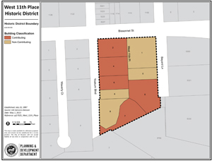
West Eleventh Place
The West Eleventh Place Historic District is located in the Rice University/Museum District area of Houston. It consists of a single city block...
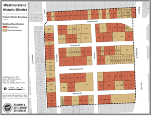
Westmoreland
The Westmoreland neighborhood, developed in 1902, is located just southwest of downtown Houston. At the time it was...
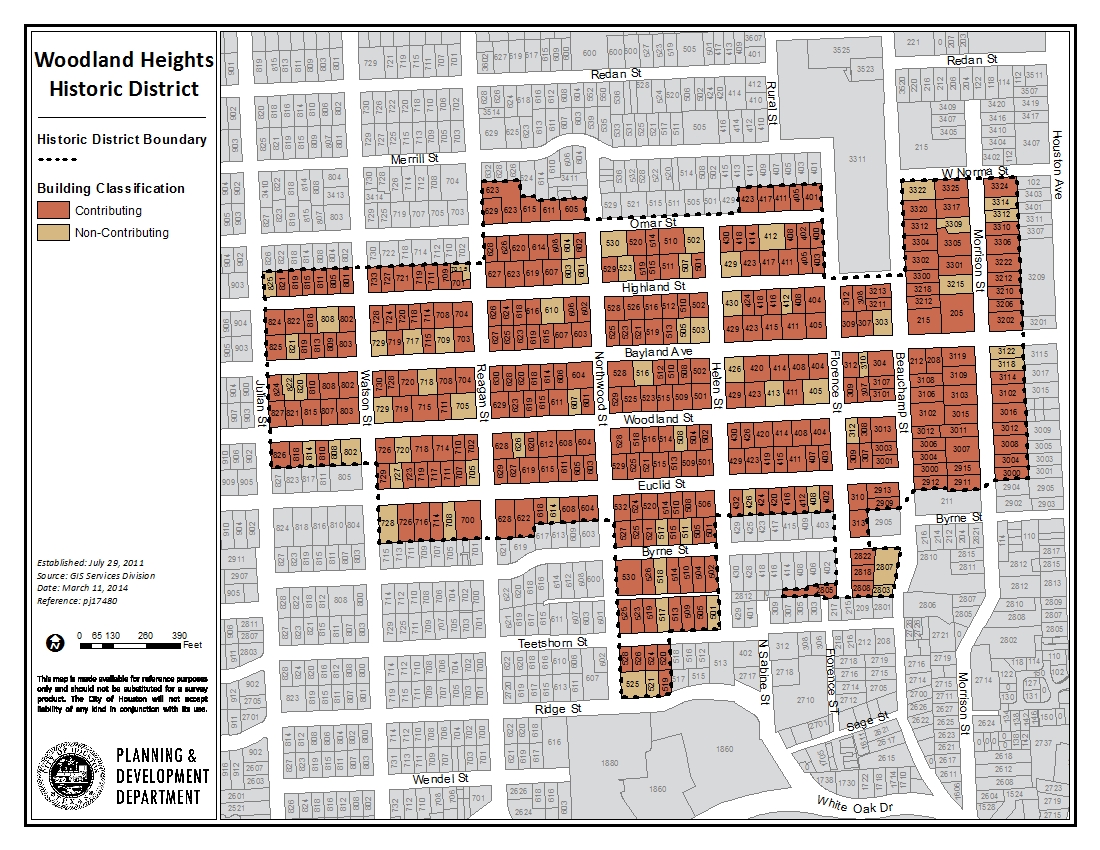
Woodland Heights
Woodland Heights is a subdivision in the greater Heights area, north of downtown Houston. The William Wilson Realty Company established Woodland Heights in 1907...
Navigation
- Audubon Place
- Avondale East and Avondale West
- Boulevard Oaks
- Broadacres
- Courtlandt Place
- First Montrose Commons
- Freeland
- Germantown
- Glenbrook Valley
- High First Ward
- Houston Heights East, South and West
- Main Street Market Square
- Norhill
- Old Sixth Ward
- Shadow Lawn
- Starkweather
- West Eleventh Place
- Westmoreland
- Woodland Heights