
Houston Bike Plan
Polk Street
Status: Complete
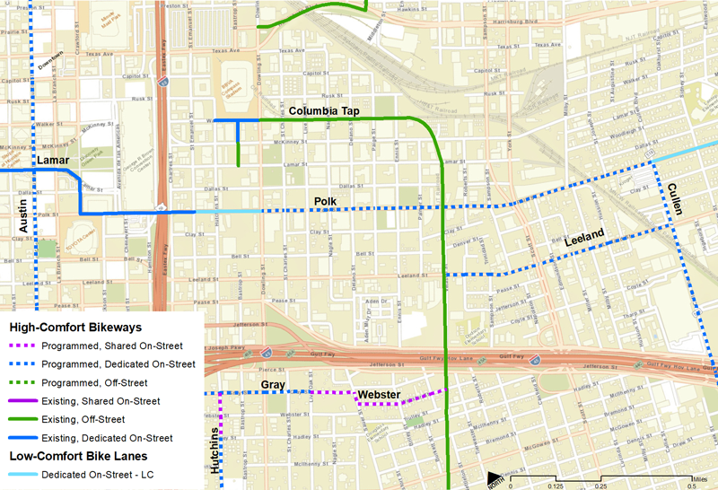
Polk Street’s high-comfort bikeway between Emancipation Avenue and Cullen Boulevard is complete. Construction replaced the former low-comfort bike lanes with protected, high-comfort lanes and included repairs to pavement, sidewalks, curb ramps and gutterse. This project is part of the Third Ward Bikeway Network and is funded Harris County Precinct One Partnership.
Route Map
The Polk Street high-comfort bikeway project (dashed blue) extends from Emancipation Ave. to Cullen Blvd.
Segment Details
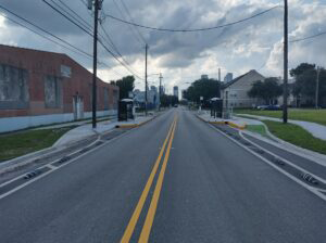
The project replaced two existing standard bike lanes with two protected bike lanes, providing a safer environment for all travelers in this section of Polk Street. The design features “floating bus stops,” which are dedicated waiting and boarding platforms for passengers adjacent to the travel lane to streamline transit service, improve accessibility and eliminate conflicts between buses and bikes at bus stops. The bike lanes continue behind the bus stop so as not to disrupt bike flow.
For a detailed view of the corridor, please refer to the final plans below
Existing Polk Street Design

Photos:

Acknowledgements
Project Partnerships
- Harris County Precinct 1
- City of Houston Planning and Development Department
- Houston Public Works
Project Management & Design Consultantss
- Jones Carter
- Traffic Engineers, Inc (TEI)
- Toole Design Group